
Hydroacoustics

By Thomas Ronge |

As mentioned before, we use sediment cores from the ocean floor for our climate reconstructions as well as for our analyses of the regional geological history. Because we are working in an area where geological data are sparse, it’s not always easy to find a suitable location.
With a water depth of several thousand meters it can take hours before our equipment is back from the seafloor. Therefore it is crucial to know if a location is worth the time or if it would be better to move on and look for a better place to core. Furthermore we risk severe damage to our equipment if we hit hard base rock instead of soft sediments. To avoid wasting time and/or damaging our equipment we usually analyze the seafloor before deploying anything.

If the bridge is the control center for the vessel, the hydroacoustic lab might be the scientific equivalent. Here we have all the computers controlling the shipboard echosounders and visualizing their data.
On Polarstern, we use two different systems. The multibeam system is emitting several hundred acoustic beams. These beams cover a wide area on the seafloor but are unable to penetrate the sediments. This system is usually used to generate highly resolved maps of the seafloor, which we can use to find suitable spots where sediments might have accumulated.
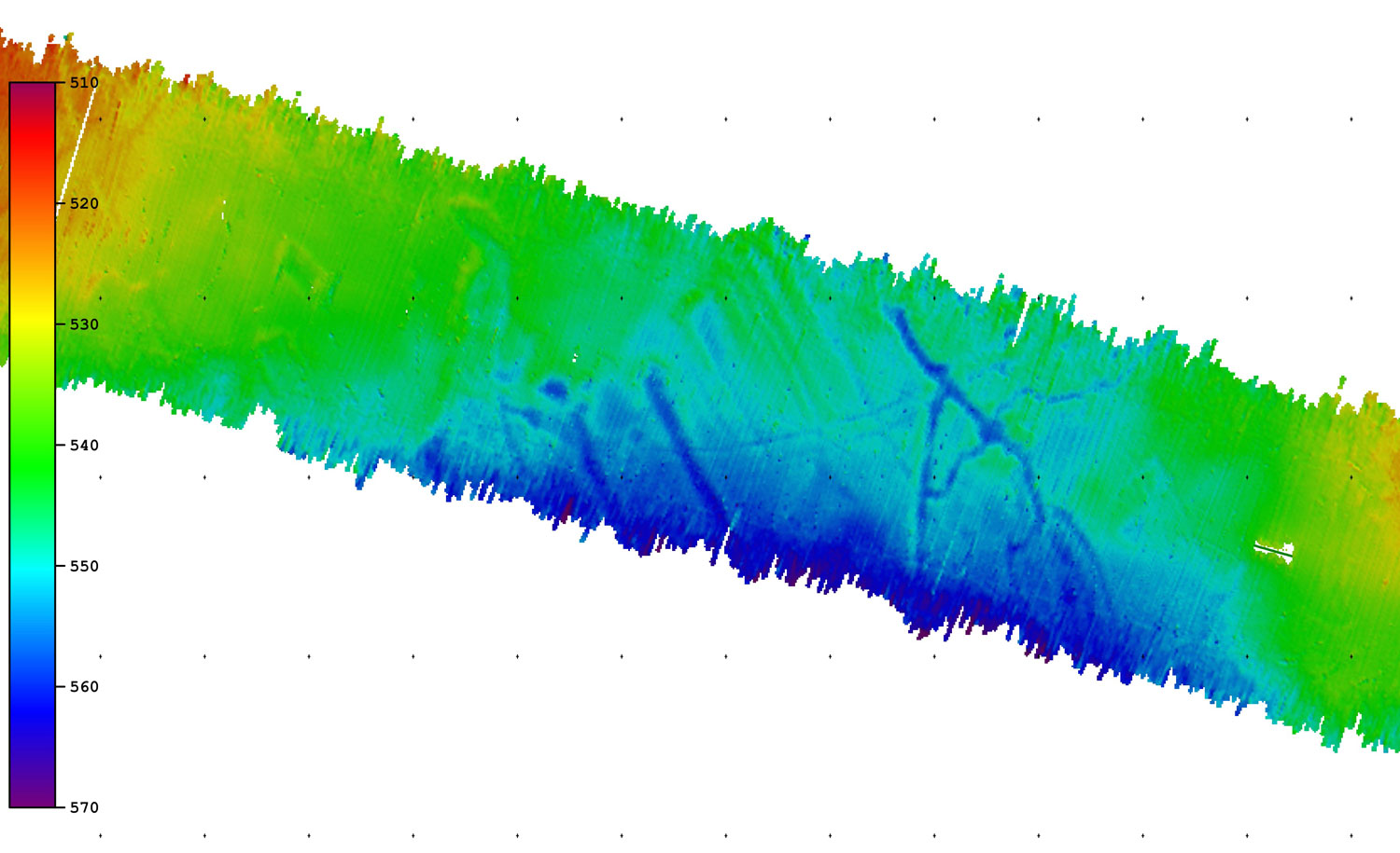
The second system, the Parasound echosounder, is operating with only one acoustic beam. Parasound enables us to look up to 200 m deep into the sediment and to assess whether the sediments are thick and interesting enough for coring or not.
To keep the systems running, two members of our bathymetry working group are operating the systems 24/7.
Once we approach a potential site, the hydroacoustic lab becomes pretty crowded. Together with other scientist, the chief scientist decides, where coring will take place and communicates this information to the officers, working on the bridge.


